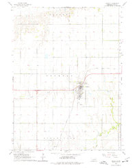
1965 Map of Osceola
USGS Topo · Published 1977About this map
Osceola serves as the focal point of this mid-1960s agricultural survey in Polk County, Nebraska. The town's grid is clearly defined, featuring the County Fairground and a central Park. This period captures the landscape just before significant modern changes, where the Union Pacific railroad corridor still dictated the local transportation network, curving through the eastern portion of the township and connecting the community to the wider regional grain markets.
Find a feature on this map
15 named features on this map. Tap any name to fly to it.
Don’t see what you’re looking for? This feature index may not catch every label — zoom into the map to look around manually.
Map Details
Editions of this 1965 Osceola Map
2 editions found
Other maps of this area

1896 · Stromsburg
USGS Topo · 1:125,000

1899 · David City
USGS Topo · 1:125,000

1955 · Fremont
USGS Topo · 1:250,000

1957 · Fremont
USGS Topo · 1:250,000

1958 · Fremont
USGS Topo · 1:250,000

1958 · Columbus SW
USGS Topo · 1:24,000

1958 · Silver Creek SE
USGS Topo · 1:24,000

1958 · Silver Creek
USGS Topo · 1:24,000
1962 · Swedehome
USGS Topo · 1:24,000
1965 · Stromsburg
USGS Topo · 1:24,000