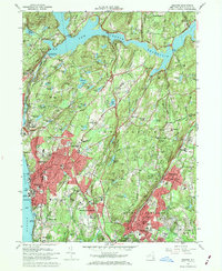
1967 Map of Ossining
USGS Topo · Published 1969About this map
Sing Sing Prison stands prominently on the eastern bank of the Hudson River in this detailed Westchester County survey. The landscape is defined by massive public works projects and institutional campuses, from the New Croton Dam and the expansive Croton Reservoir in the north to the subterranean paths of the Catskill Aqueduct and Old Croton Aqueduct. These engineering marvels cut through a region of high ridges like Bald Mtn and Stayback Hill, supporting the dense residential growth of Ossining and Briarcliff Manor.
Find a feature on this map
136 named features on this map. Tap any name to fly to it.
Don’t see what you’re looking for? This feature index may not catch every label — zoom into the map to look around manually.
Map Details
Editions of this 1967 Ossining Map
4 editions found
Other maps of this area

1892 · Stamford
USGS Topo · 1:62,500

1892 · West Point
USGS Topo · 1:62,500

1892 · Carmel
USGS Topo · 1:62,500

1892 · Tarrytown
USGS Topo · 1:62,500

1893 · Carmel
USGS Topo · 1:62,500

1893 · Stamford
USGS Topo · 1:62,500

1893 · Tarrytown
USGS Topo · 1:62,500

1894 · West Point
USGS Topo · 1:62,500

1894 · Carmel
USGS Topo · 1:62,500

1899 · Stamford
USGS Topo · 1:62,500