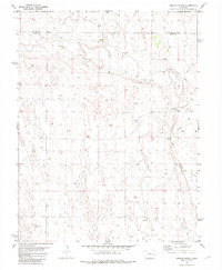
1982 Map of Oswald Ranch
USGS Topo · Published 1982About this map
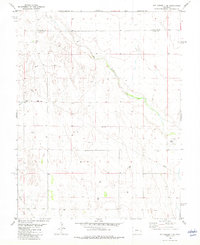
Oswald Ranch serves as a lonely landmark in this high-plains landscape, situated just south of the border where Cheyenne Co meets Kiowa County. The terrain is defined by the wandering path of Rush Creek, which meanders through the eastern portion of the quadrangle. This 1982 edition illustrates the sparse ranching and utility infrastructure of the era, marked by a network of wells, several springs, and a prominent Aqueduct and Pipeline cutting across the territory. Industrial activity is limited but present, indicated by a localized Gravel Pit. The map reflects a quiet, functional environment where water management and cattle ranching are the primary human imprints on the vast Colorado plains during the early 1980s.
Find a feature on this map
8 named features on this map. Tap any name to fly to it.
Don’t see what you’re looking for? This feature index may not catch every label — zoom into the map to look around manually.
Map Details
Editions of this 1982 Oswald Ranch Map
This is the sole edition of this map. No revisions or reprints were ever made.
Other maps of this area

1891 · Kit Carson
USGS Topo · 1:125,000

1892 · Lamar
USGS Topo · 1:125,000

1893 · Kit Carson
USGS Topo · 1:125,000

1954 · Lamar
USGS Topo · 1:250,000

1958 · Lamar
USGS Topo · 1:250,000
1968 · Alkali Lake
USGS Topo · 1:24,000
1968 · Chivington
USGS Topo · 1:24,000
1968 · Eads
USGS Topo · 1:24,000

1981 · Cheyenne Wells
USGS Topo · 1:100,000
1982 · Kit Carson 4 SE
USGS Topo · 1:24,000