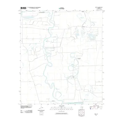
2010 Map of Otey
USGS Topo · Published 2010About this map
The Brazos River snakes through the center of this landscape, its complex meanders and oxbows defining the geography of south-central Texas. Small communities like Otey, Lochridge, and Orozimbo are scattered across the alluvial plain, connected by a network of rural routes including FM 655 and Sandy Point RD. The map reveals a transition between agricultural land and state infrastructure, notably the extensive grounds of the Ramsey State Prison Farm situated along the banks of Oyster Creek.
Find a feature on this map
49 named features on this map. Tap any name to fly to it.
Don’t see what you’re looking for? This feature index may not catch every label — zoom into the map to look around manually.
Map Details
Editions of this 2010 Otey Map
This is the sole edition of this map. No revisions or reprints were ever made.
Other maps of this area

1943 · Rosharon
USGS Topo · 1:31,680

1943 · Juliff
USGS Topo · 1:31,680

1943 · Angleton
USGS Topo · 1:24,000

1950 · Houston
USGS Topo · 1:250,000

1952 · West Columbia
USGS Topo · 1:24,000

1952 · East Columbia
USGS Topo · 1:24,000

1953 · Lake George
USGS Topo · 1:24,000

1953 · Damon
USGS Topo · 1:24,000

1953 · Otey
USGS Topo · 1:24,000

1953 · Thompsons
USGS Topo · 1:24,000