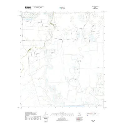
2019 Map of Otey
USGS Topo · Published 2019About this map
The Brazos River meanders through the heart of this coastal prairie landscape, defining the winding boundary between Brazoria County and Fort Bend County. The map details a transition from the agricultural expansion of Alvin to the more rural ranchlands near Lochridge. Significant water management features dominate the hydrology, including the expansive Harris Reservoir and Reservoir Number 8, which sit alongside natural oxbows and waterways like Oyster Creek and Pecan Bayou. Local property history is reflected in the naming of modern rural tracts and landmarks such as Moyle Ranch and Moon Lake Ranch. The terrain is crisscrossed by a dense network of recreational trails and farm roads, including the 40 Acre Lake Trail and Spillway Trail, which navigate the wetlands and lakeshores typical of this Gulf Coast region. This survey captures the intricate drainage patterns and small-scale developments at the edge of the expanding Houston metropolitan area.
Find a feature on this map
78 named features on this map. Tap any name to fly to it.
Don’t see what you’re looking for? This feature index may not catch every label — zoom into the map to look around manually.
Map Details
Editions of this 2019 Otey Map
This is the sole edition of this map. No revisions or reprints were ever made.
Other maps of this area

1943 · Rosharon
USGS Topo · 1:31,680

1943 · Juliff
USGS Topo · 1:31,680

1943 · Angleton
USGS Topo · 1:24,000

1950 · Houston
USGS Topo · 1:250,000

1952 · West Columbia
USGS Topo · 1:24,000

1952 · East Columbia
USGS Topo · 1:24,000

1953 · Lake George
USGS Topo · 1:24,000

1953 · Damon
USGS Topo · 1:24,000

1953 · Otey
USGS Topo · 1:24,000

1953 · Thompsons
USGS Topo · 1:24,000