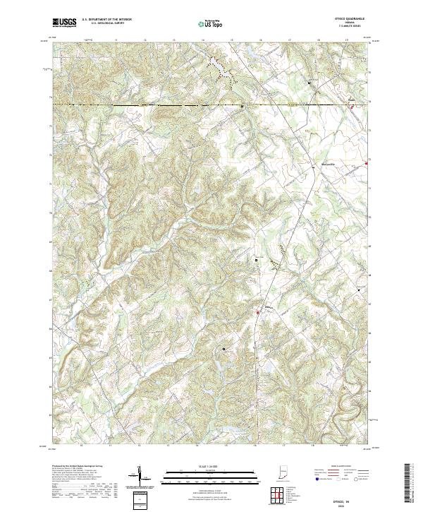
2022 Map of Otisco
USGS Topo · Published 2022About this map
Otisco and Marysville anchor this rural landscape in northern Clark County, where the terrain is defined by the dendritic drainage patterns of Silver Cr and Fourteenmile Cr. The map reveals a settlement pattern tied to early thoroughfares like Old State Rd 3 and Nabb Marysville Rd, which connect small communities and family farmsteads. Genealogists will find a wealth of local history preserved in the numerous small burial grounds scattered across the townships, including Bethel Cem, Beswick Cem, and Kern Cem. To the north, the village of Nabb sits on the Scott County line, while smaller water bodies such as Marysville Lake and Shady Hollow Lake dot the valleys. The intricate network of secondary roads, like Brewer Rd and Zollman Rd, illustrates the persistent agricultural and residential framework of this southern Indiana region.
Find a feature on this map
90 named features on this map. Tap any name to fly to it.
Don’t see what you’re looking for? This feature index may not catch every label — zoom into the map to look around manually.
Map Details
Editions of this 2022 Otisco Map
This is the sole edition of this map. No revisions or reprints were ever made.
Other maps of this area

1905 · Prospect
USGS Topo · 1:62,500

1912 · Prospect
USGS Topo · 1:62,500

1937 · Charlestown
USGS Topo · 1:24,000

1938 · Owen
USGS Topo · 1:24,000

1938 · Speed
USGS Topo · 1:24,000

1947 · Speed
USGS Topo · 1:24,000

1947 · Scottsburg
USGS Topo · 1:24,000

1948 · Owen
USGS Topo · 1:24,000

1949 · Henryville
USGS Topo · 1:24,000
1950 · Charlestown
USGS Topo · 1:24,000