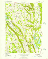
1955 Map of Otisco Valley
USGS Topo · Published 1956About this map
Otisco Lake and the steep glacial terrain of the Finger Lakes region define this mid-century landscape. The map captures the agricultural and seasonal character of the area, with numerous small settlements such as Otisco Valley and Vesper dotting the valley floors. In the east, the Onondaga Valley serves as a corridor for the D L & W RR, while a string of kettle lakes including Song Lake, Crooked Lake, and Tully Lake provide a focus for recreation at Assembly Park and Tully Lake Park. Local family names are preserved through landmarks like Canty Hill, Ripley Hill, and Dutch Hill. Genealogists will find several burial grounds noted, including St Patricks Cem near the northern border and the Otisco Valley Cem located along Church Road. The varied topography is further marked by dramatic features like Bucktail Falls and Rattlesnake Gulf.
Find a feature on this map
85 named features on this map. Tap any name to fly to it.
Don’t see what you’re looking for? This feature index may not catch every label — zoom into the map to look around manually.
Map Details
Editions of this 1955 Otisco Valley Map
4 editions found
Other maps of this area

1898 · Moravia
USGS Topo · 1:62,500

1899 · Skaneateles
USGS Topo · 1:62,500

1900 · Tully
USGS Topo · 1:62,500

1902 · Skaneateles
USGS Topo · 1:62,500

1902 · Moravia
USGS Topo · 1:62,500

1903 · Cortland
USGS Topo · 1:62,500

1943 · South Onondaga
USGS Topo · 1:31,680

1943 · Spafford
USGS Topo · 1:31,680

1943 · Jamesville
USGS Topo · 1:31,680

1943 · Otisco Valley
USGS Topo · 1:31,680