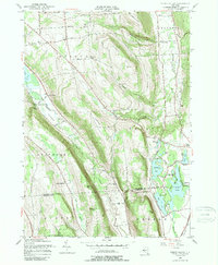
1955 Map of Otisco Valley
USGS Topo · Published 1989About this map
Otisco Lake and the dramatic glacial valleys of the Onondaga Highlands define this 1955 survey. The landscape is characterized by steep ridges like Dutch Hill and Vesper Hill, which divide the drainages of Onondaga Creek and the Otisco Valley Creek. Settlement is concentrated in small upland hamlets such as Vesper, Otisco, and Tully Center, while the lowlands near Tully Lake show evidence of recreation and industry, including Assembly Park, Camp Hoover, and several Salt Wells. The presence of numerous small cemeteries, such as Hillsdale Cem and Neumans Cem, alongside the Otisco Valley Church, provides specific touchpoints for genealogical research in this rural New York township. The D L & W railroad corridor follows the valley floor in the east, tracing the natural path through the hills.
Find a feature on this map
76 named features on this map. Tap any name to fly to it.
Don’t see what you’re looking for? This feature index may not catch every label — zoom into the map to look around manually.
Map Details
Editions of this 1955 Otisco Valley Map
4 editions found
Other maps of this area

1898 · Moravia
USGS Topo · 1:62,500

1899 · Skaneateles
USGS Topo · 1:62,500

1900 · Tully
USGS Topo · 1:62,500

1902 · Skaneateles
USGS Topo · 1:62,500

1902 · Moravia
USGS Topo · 1:62,500

1903 · Cortland
USGS Topo · 1:62,500

1943 · South Onondaga
USGS Topo · 1:31,680

1943 · Spafford
USGS Topo · 1:31,680

1943 · Jamesville
USGS Topo · 1:31,680

1943 · Otisco Valley
USGS Topo · 1:31,680