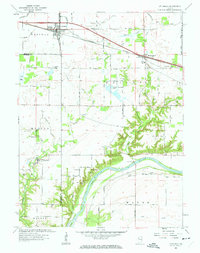
1961 Map of Otterbein
USGS Topo · Published 1963About this map
The Wabash River carves through the southern portion of this region, defining a landscape where agriculture and higher education research intersect. To the north, the town of Otterbein sits at a rail junction near the Benton Co Tippecanoe Co line, while the community of Montmorenci serves as a hub further east, complete with its Morenci High Sch and industrial Storage Bins.
Find a feature on this map
54 named features on this map. Tap any name to fly to it.
Don’t see what you’re looking for? This feature index may not catch every label — zoom into the map to look around manually.
Map Details
Editions of this 1961 Otterbein Map
3 editions found

Other maps of this area

1941 · Lafayette
USGS Topo · 1:24,000

1942 · Otterbein
USGS Topo · 1:24,000

1942 · Lafayette
USGS Topo · 1:24,000

1950 · Lafayette
USGS Topo · 1:24,000

1951 · Otterbein
USGS Topo · 1:24,000

1953 · Danville
USGS Topo · 1:250,000

1955 · Danville
USGS Topo · 1:250,000

1956 · Danville
USGS Topo · 1:250,000

1961 · Chatterton
USGS Topo · 1:24,000

1961 · Romney
USGS Topo · 1:24,000