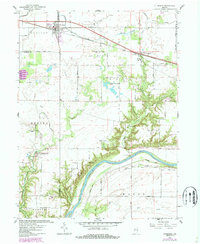
1961 Map of Otterbein
USGS Topo · Published 1987About this map
The Wabash River forms the southern corridor of this Indiana landscape, where the Abandoned Canal traces the historic water-driven economy of the region. The map captures a transition from the agricultural plains of Bolivar and Medina to the more varied terrain of The Hills. Central to the cultural geography are several country burial grounds and houses of worship, including Pond Grove Cem, Armstrong Chapel, and Asbury Cem, which anchor the rural community.
Find a feature on this map
47 named features on this map. Tap any name to fly to it.
Don’t see what you’re looking for? This feature index may not catch every label — zoom into the map to look around manually.
Map Details
Editions of this 1961 Otterbein Map
3 editions found

Other maps of this area

1941 · Lafayette
USGS Topo · 1:24,000

1942 · Otterbein
USGS Topo · 1:24,000

1942 · Lafayette
USGS Topo · 1:24,000

1950 · Lafayette
USGS Topo · 1:24,000

1951 · Otterbein
USGS Topo · 1:24,000

1953 · Danville
USGS Topo · 1:250,000

1955 · Danville
USGS Topo · 1:250,000

1956 · Danville
USGS Topo · 1:250,000

1961 · Chatterton
USGS Topo · 1:24,000

1961 · Romney
USGS Topo · 1:24,000