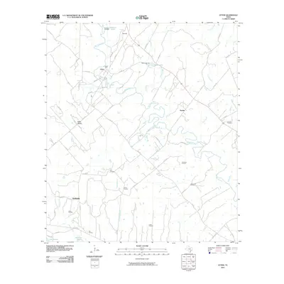
2010 Map of Ottine
USGS Topo · Published 2010About this map
The San Marcos River and Guadalupe River converge in this corner of South Texas, defining a landscape of riparian lowlands and agricultural tracts. This 2010 survey shows the rural settlements of Ottine and Slayden situated among the winding river bends, where water management is marked by the Zedlar Dam and Glasscock Lake Dam. A high density of family and community burial grounds, including McKeller Cemetery, Princeville Cemetery, and Hodge Cemetery, reveals the deep roots of the local population throughout the 20th century. In the southwest, Smithville sits near the banks of Clemens Creek as it approaches the Guadalupe River at Lake Gonzales. The presence of Park RD 11 N and multiple state-maintained farm-to-market roads suggests a transition between preserved natural river areas and the established ranching and farming infrastructure that has supported the county for generations.
Find a feature on this map
60 named features on this map. Tap any name to fly to it.
Don’t see what you’re looking for? This feature index may not catch every label — zoom into the map to look around manually.
Map Details
Editions of this 2010 Ottine Map
This is the sole edition of this map. No revisions or reprints were ever made.
Other maps of this area

1901 · Flatonia
USGS Topo · 1:125,000

1911 · San Marcos
USGS Topo · 1:125,000

1919 · San Marcos
USGS Topo · 1:125,000

1920 · Smiley
USGS Topo · 1:125,000

1925 · San Marcos 4-c
USGS Topo · 1:48,000

1925 · San Marcos 4-a
USGS Topo · 1:48,000

1929 · Luling
USGS Topo · 1:62,500

1953 · Seguin
USGS Topo · 1:250,000

1958 · Seguin
USGS Topo · 1:250,000

1959 · Ottine
USGS Topo · 1:24,000