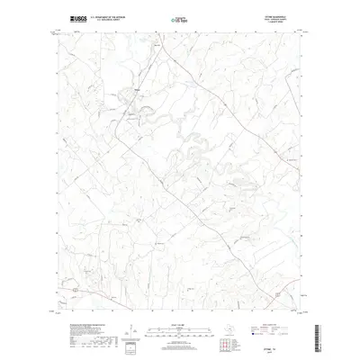
2019 Map of Ottine
USGS Topo · Published 2019About this map
The San Marcos River serpentines through the heart of this landscape near the settlement of Ottine, carving a complex riparian network defined by tight oxbows and numerous tributaries. This Gonzales County terrain is marked by a high density of family and community burial grounds, including McKeller Cem, Princeville Cem, and Greenwood Cem, which serve as vital markers for genealogical research in the region. To the north, the elevation rises toward Red Hill and contains water bodies such as Glasscock Lake and Benke Lake. The map details a transition from the river bottomlands to the surrounding uplands, connected by a web of rural routes like FM 1586 and FM 2091. The presence of scattered landmarks like Hodge Cem and Randle Cem across the southern half of the quadrangle suggests a long history of small-scale rural settlement away from the primary river corridor.
Find a feature on this map
55 named features on this map. Tap any name to fly to it.
Don’t see what you’re looking for? This feature index may not catch every label — zoom into the map to look around manually.
Map Details
Editions of this 2019 Ottine Map
This is the sole edition of this map. No revisions or reprints were ever made.
Other maps of this area

1901 · Flatonia
USGS Topo · 1:125,000

1911 · San Marcos
USGS Topo · 1:125,000

1919 · San Marcos
USGS Topo · 1:125,000

1920 · Smiley
USGS Topo · 1:125,000

1925 · San Marcos 4-c
USGS Topo · 1:48,000

1925 · San Marcos 4-a
USGS Topo · 1:48,000

1929 · Luling
USGS Topo · 1:62,500

1953 · Seguin
USGS Topo · 1:250,000

1958 · Seguin
USGS Topo · 1:250,000

1959 · Ottine
USGS Topo · 1:24,000