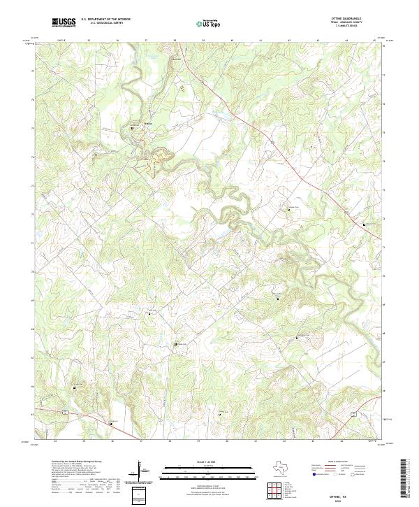
2022 Map of Ottine
USGS Topo · Published 2022About this map
The San Marcos River snakes through this portion of Gonzales County, defining a landscape of wetlands and winding waterways. The settlement of Ottine serves as a focal point near the northern edge, surrounded by specialized trails including the Ottine Swamp Trl, Mesquite Flats Trl, and the San Marcos River Trl. This area is particularly notable for its high density of family and community burial grounds, which are scattered throughout the rural acreage. Genealogists will find a wealth of specific locations to investigate, from the Ottine Cem and Slayden Cem in the north to the Foster Cem and King Cem in the south. The terrain is further shaped by several water bodies like Glasscock Lake and Benke Lake, alongside numerous creeks such as Artesia Cr and Canoe Cr that feed into the primary river system.
Find a feature on this map
60 named features on this map. Tap any name to fly to it.
Don’t see what you’re looking for? This feature index may not catch every label — zoom into the map to look around manually.
Map Details
Editions of this 2022 Ottine Map
This is the sole edition of this map. No revisions or reprints were ever made.
Other maps of this area

1901 · Flatonia
USGS Topo · 1:125,000

1911 · San Marcos
USGS Topo · 1:125,000

1919 · San Marcos
USGS Topo · 1:125,000

1920 · Smiley
USGS Topo · 1:125,000

1925 · San Marcos 4-c
USGS Topo · 1:48,000

1925 · San Marcos 4-a
USGS Topo · 1:48,000

1929 · Luling
USGS Topo · 1:62,500

1953 · Seguin
USGS Topo · 1:250,000

1958 · Seguin
USGS Topo · 1:250,000

1959 · Ottine
USGS Topo · 1:24,000