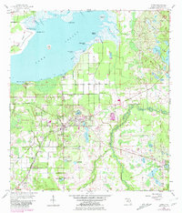
1956 Map of Oviedo
USGS Topo · Published 1981About this map
Lake Jessup dominates the northern horizon of this mid-century landscape, its southern shoreline defined by a complex network of marshes including Marl Bed Slough and Marl Bed Flats. The agricultural and rail history of the region is evident in the layout of Oviedo, which sits at a junction of the Seaboard Coast Line. To the south, the settlement of Slavia and the Slavia Cem reflect the distinct heritage of the area, while the eastern reaches are defined by the winding course of the Econlockhatchee River. This 1956 survey, updated with 1980 photorevisions, documents the early suburban expansion of Winter Springs alongside older landings and coves like Whites Landing and Willow Cove. The map also captures the expansive citrus and farming lands within Black Hammock and Mitchell Hammock before the rapid urbanization of the late 20th century.
Find a feature on this map
55 named features on this map. Tap any name to fly to it.
Don’t see what you’re looking for? This feature index may not catch every label — zoom into the map to look around manually.
Map Details
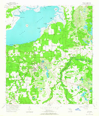
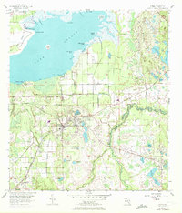
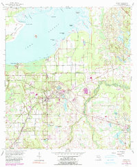
Editions of this 1956 Oviedo Map
5 editions found
Other maps of this area

1949 · Osceola
USGS Topo · 1:24,000

1953 · Geneva
USGS Topo · 1:24,000

1953 · Oviedo SW
USGS Topo · 1:24,000

1953 · Bithlo
USGS Topo · 1:24,000

1955 · Orlando
USGS Topo · 1:250,000

1956 · Oviedo
USGS Topo · 1:24,000

1956 · Orlando East
USGS Topo · 1:24,000

1957 · Orlando
USGS Topo · 1:250,000

1958 · Orlando
USGS Topo · 1:250,000

1962 · Orlando
USGS Topo · 1:250,000