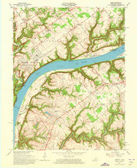
1961 Map of Owen
USGS Topo · Published 1973About this map
The Ohio River carves a deep valley through this borderland between Kentucky and Indiana, dominated on the northern bank by the expansive U S Military Reservation Indiana Arsenal. This 1961 revision documents a landscape of dramatic elevation changes, where the river flows at a normal pool of 420 feet beneath high bluffs like Devils Backbone. Long-standing rural life is evident in the cluster of houses at Vesta and the numerous small congregations such as Owen Creek Ch and Shiloh Ch.
Find a feature on this map
55 named features on this map. Tap any name to fly to it.
Don’t see what you’re looking for? This feature index may not catch every label — zoom into the map to look around manually.
Map Details
Editions of this 1961 Owen Map
4 editions found
Other maps of this area

1905 · Prospect
USGS Topo · 1:62,500

1912 · Prospect
USGS Topo · 1:62,500

1932 · La Grange
USGS Topo · 1:62,500

1937 · Jeffersonville
USGS Topo · 1:24,000

1937 · Charlestown
USGS Topo · 1:24,000

1938 · Owen
USGS Topo · 1:24,000

1939 · Bethlehem
USGS Topo · 1:24,000

1946 · Jeffersonville
USGS Topo · 1:24,000

1948 · Bethlehem
USGS Topo · 1:24,000

1948 · Owen
USGS Topo · 1:24,000