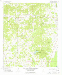
1964 Map of Owens Wells
USGS Topo · Published 1978About this map
Holmes County State Park serves as a central landmark in this 1964 Mississippi survey, illustrating the recreational development within the heart of Holmes County. The landscape is defined by the winding course of the Big Black River at the southern boundary and the Illinois Central railroad cutting through the eastern edge. Local life is documented through small clusters like Owens Wells and McMillan, alongside numerous country churches such as Union Paradise Ch and Mt Sinai Ch.
Find a feature on this map
32 named features on this map. Tap any name to fly to it.
Don’t see what you’re looking for? This feature index may not catch every label — zoom into the map to look around manually.
Map Details
Editions of this 1964 Owens Wells Map
3 editions found
Other maps of this area

1940 · Lexington
USGS Topo · 1:62,500

1953 · Meridian
USGS Topo · 1:250,000

1953 · Greenwood
USGS Topo · 1:250,000

1953 · West Point
USGS Topo · 1:250,000

1955 · Jackson
USGS Topo · 1:250,000

1956 · Greenwood
USGS Topo · 1:250,000

1957 · Meridian
USGS Topo · 1:250,000

1957 · Lexington
USGS Topo · 1:62,500

1958 · West Point
USGS Topo · 1:250,000

1958 · Lexington
USGS Topo · 1:62,500