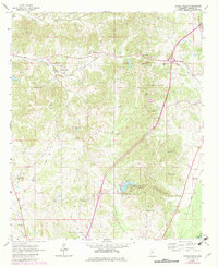
1964 Map of Owens Wells
USGS Topo · Published 1982About this map
Owens Wells serves as a central landmark in this 1960s landscape, situated along the Illinois Central Gulf railroad line. The map illustrates a rural Mississippi community defined by its watercourses and a dense network of country churches, including Union Paradise Ch and Franklin Ch. A significant historical demarcation, the Old Indian Treaty Bdy, cuts across the northern section, providing a clear reference to earlier territorial divisions. To the south, Holmes County State Park occupies a rugged area centered on a local reservoir, contrasting with the agricultural and rail-oriented settlements like McMillan and Aberdeen Junction. The distribution of family and community burial sites, such as Gages Springs Cem and Macedonia Cem, offers researchers specific geographic anchors for local family histories.
Find a feature on this map
32 named features on this map. Tap any name to fly to it.
Don’t see what you’re looking for? This feature index may not catch every label — zoom into the map to look around manually.
Map Details
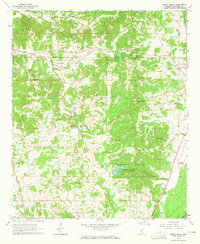
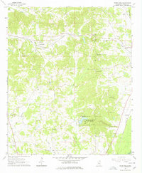
Editions of this 1964 Owens Wells Map
3 editions found
Other maps of this area

1940 · Lexington
USGS Topo · 1:62,500

1953 · Meridian
USGS Topo · 1:250,000

1953 · Greenwood
USGS Topo · 1:250,000

1953 · West Point
USGS Topo · 1:250,000

1955 · Jackson
USGS Topo · 1:250,000

1956 · Greenwood
USGS Topo · 1:250,000

1957 · Meridian
USGS Topo · 1:250,000

1957 · Lexington
USGS Topo · 1:62,500

1958 · West Point
USGS Topo · 1:250,000

1958 · Lexington
USGS Topo · 1:62,500