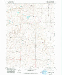
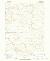
1971 Map of Owinza Butte
USGS Topo · Published 1992About this map
Owinza Butte serves as the central landmark for this high desert landscape along the border of Lincoln and Jerome counties. The terrain is defined by a complex network of seasonal catchments and irrigation infrastructure, notably the Aqueduct that cuts across the northeastern corner. The names of the various water bodies—ranging from larger pools like Owinza Butte Lake and Mallard Lake to smaller catchments such as One Shot Lake and Tumbleweed Reservoir—suggest a landscape managed for livestock and wildlife. This 1971 survey, updated with 1980s aerial data, reveals a high desert environment where human impact is limited to industrial sites like the Cinder Pit and a series of reservoirs, including Elden Reservoir and Bill Reservoir, which supported the agricultural needs of the Snake River Plain region.
Find a feature on this map
27 named features on this map. Tap any name to fly to it.
Don’t see what you’re looking for? This feature index may not catch every label — zoom into the map to look around manually.
Map Details
Editions of this 1971 Owinza Butte Map
2 editions found
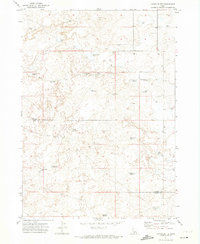
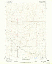
Other maps of this area

1954 · Pocatello
USGS Topo · 1:250,000

1955 · Twin Falls
USGS Topo · 1:250,000

1958 · Twin Falls
USGS Topo · 1:250,000

1958 · Pocatello
USGS Topo · 1:250,000
1964 · Burley NW
USGS Topo · 1:24,000
1964 · Hazelton NE
USGS Topo · 1:24,000
1964 · Hunt
USGS Topo · 1:24,000
1971 · Star Lake
USGS Topo · 1:24,000
1971 · Owinza
USGS Topo · 1:24,000
1971 · Dietrich Butte
USGS Topo · 1:24,000