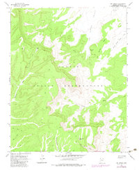
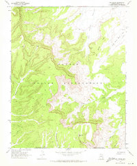
1968 Map of Owl Spring
USGS Topo · Published 1983About this map
Navajo Indian Reservation lands dominate this late-1960s topographic study, revealing a landscape defined by high mesas and deep drainage basins. Archeological presence is indicated by the Cliff Dwelling tucked near Rock Gap, while the water resources of Owl Spring and the curiously named Many Skull Spring provide focal points in an otherwise arid environment. The map details a transition across the Old Indian Reservation Boundary, cutting through varied terrain from the heights of Small White Mesa down to the low reaches of Dipping Bucket Valley.
Find a feature on this map
20 named features on this map. Tap any name to fly to it.
Don’t see what you’re looking for? This feature index may not catch every label — zoom into the map to look around manually.
Map Details
Editions of this 1968 Owl Spring Map
3 editions found
Other maps of this area

1883 · Marsh Pass
USGS Topo · 1:250,000

1892 · Marsh Pass
USGS Topo · 1:250,000

1956 · Marble Canyon
USGS Topo · 1:250,000

1959 · Marble Canyon
USGS Topo · 1:250,000

1961 · Marble Canyon
USGS Topo · 1:250,000
1968 · Kayenta East
USGS Topo · 1:24,000
1968 · Kayenta West
USGS Topo · 1:24,000
1968 · Owl Spring
USGS Topo · 1:24,000

1968 · Yucca Hill
USGS Topo · 1:24,000
1968 · Chilchinbito
USGS Topo · 1:24,000