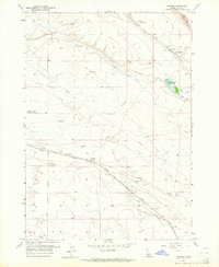
1957 Map of Owyhee
USGS Topo · Published 1959About this map
The high desert of Pleasant Valley is defined by its strategic transportation and water infrastructure in the late 1950s. The Union Pacific (Oregon Short Line) cuts a diagonal path across the arid terrain, anchored by the small station or stop at Owyhee, which is marked by a specific Water Tank along the tracks. This rail corridor follows the natural drainage of Indian Creek, a vital watercourse in this dry region of Ada County.
Find a feature on this map
18 named features on this map. Tap any name to fly to it.
Don’t see what you’re looking for? This feature index may not catch every label — zoom into the map to look around manually.
Map Details
Editions of this 1957 Owyhee Map
3 editions found
Other maps of this area

1892 · Boise
USGS Topo · 1:125,000

1892 · Bisuka
USGS Topo · 1:125,000

1894 · Bisuka
USGS Topo · 1:125,000

1897 · Boise
USGS Topo · 1:125,000

1953 · Cloverdale
USGS Topo · 1:24,000

1954 · Boise South
USGS Topo · 1:24,000

1954 · Boise
USGS Topo · 1:62,500

1955 · Christmas Mtn
USGS Topo · 1:24,000
1955 · Coyote Butte
USGS Topo · 1:24,000

1955 · Orchard
USGS Topo · 1:24,000