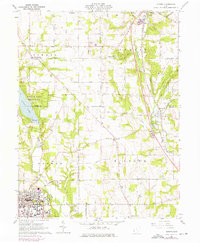
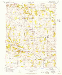
1961 Map of Oxford
USGS Topo · Published 1976About this map
Miami University and Western College anchor the southern portion of this landscape, where the college town of Oxford meets the agricultural townships of Israel, Somers, and Milford. The terrain is defined by the significant north-south drainage of Four Mile Creek and Sevenmile Creek, with the large Acton Lake reservoir dominating the northwest corner within Hueston Woods State Park. A distinct mid-century transportation and utility network is visible, from the Penn Central rail lines passing through Somerville to the local Waterworks and radio towers like Radio Tower (WMUB). Numerous family-named roads and small crossroads settlements like Morning Sun and Darrtown reflect a persistent rural structure, while the presence of the Covered Bridge on Four Mile Creek near the university suggests a landscape where 19th-century infrastructure remained integrated with 20th-century institutional growth.
Find a feature on this map
55 named features on this map. Tap any name to fly to it.
Don’t see what you’re looking for? This feature index may not catch every label — zoom into the map to look around manually.
Map Details
Editions of this 1961 Oxford Map
4 editions found
Other maps of this area

1911 · Oxford
USGS Topo · 1:62,500

1915 · College Corner
USGS Topo · 1:48,000

1915 · Harrison
USGS Topo · 1:48,000

1915 · Hamilton
USGS Topo · 1:62,500

1917 · Hamilton
USGS Topo · 1:62,500

1918 · College Corner
USGS Topo · 1:62,500

1953 · Cincinnati
USGS Topo · 1:250,000

1955 · Hamilton
USGS Topo · 1:24,000

1955 · Reily
USGS Topo · 1:24,000
1955 · Millville
USGS Topo · 1:24,000