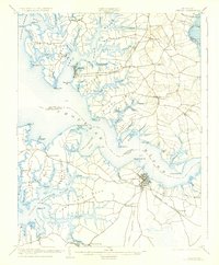
1904 Map of Oxford
USGS Topo · Published 1927About this map
Cambridge serves as a primary hub on this early twentieth-century survey, situated at the junction of the Choptank River and the Cambridge and Seaford RR. The landscape is defined by the deep indentations of the Chesapeake Bay's eastern shore, where maritime life centered around facilities like Trappe Ldg. and Corners Wharf. Smaller rural settlements such as Christs Rock, Dailsville, and Woolford P.O. Milton are connected by a network of local roads, reflecting the era's agricultural and seafaring economy.
Find a feature on this map
102 named features on this map. Tap any name to fly to it.
Don’t see what you’re looking for? This feature index may not catch every label — zoom into the map to look around manually.
Map Details
Editions of this 1904 Oxford Map
3 editions found

Other maps of this area

1892 · Drum Point
USGS Topo · 1:62,500

1892 · Annapolis
USGS Topo · 1:62,500

1893 · Sharps Island
USGS Topo · 1:62,500

1898 · Choptank
USGS Topo · 1:125,000

1898 · St. Marys
USGS Topo · 1:125,000

1901 · Drum Point
USGS Topo · 1:62,500

1903 · Nanticoke
USGS Topo · 1:62,500

1904 · St. Michaels
USGS Topo · 1:62,500

1904 · Annapolis
USGS Topo · 1:62,500

1904 · Sharps Island
USGS Topo · 1:62,500