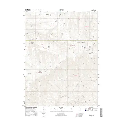
2017 Map of P R Spring
USGS Topo · Published 2017About this map
P R Spring serves as a critical water source in the high desert environment on the boundary of Uintah and Grand Counties. The landscape is defined by a series of prominent high-altitude plateaus and drainage systems, including the extensive Seep Ridge, Monument Ridge, and Pope Well Ridge. This 2017 survey details the complex network of canyons that carve through the Book Cliffs, with Black Horse Canyon and Whetrock Canyon feeding into larger systems. The presence of routes like Bookcliff Ridge Rd and Main Canyon Rd highlights the traditional transport corridors used for land management and resource access in this part of the Uinta Basin. Notable landmarks such as Mexico Point and Paradise Hill provide significant navigational aids across the dissected terrain, illustrating the geographic isolation and the naming conventions of early settlers and ranchers in the region.
Find a feature on this map
37 named features on this map. Tap any name to fly to it.
Don’t see what you’re looking for? This feature index may not catch every label — zoom into the map to look around manually.
Map Details
Editions of this 2017 P R Spring Map
This is the sole edition of this map. No revisions or reprints were ever made.
Other maps of this area

1885 · East Tavaputs
USGS Topo · 1:250,000

1956 · Grand Junction
USGS Topo · 1:250,000

1959 · Grand Junction
USGS Topo · 1:250,000

1960 · Grand Junction
USGS Topo · 1:250,000

1962 · Grand Junction
USGS Topo · 1:250,000

1964 · Grand Junction
USGS Topo · 1:250,000

1965 · Grand Junction
USGS Topo · 1:250,000

1966 · Seep Canyon
USGS Topo · 1:24,000

1966 · Tom Patterson Canyon
USGS Topo · 1:24,000
1966 · Pine Spring Canyon
USGS Topo · 1:24,000