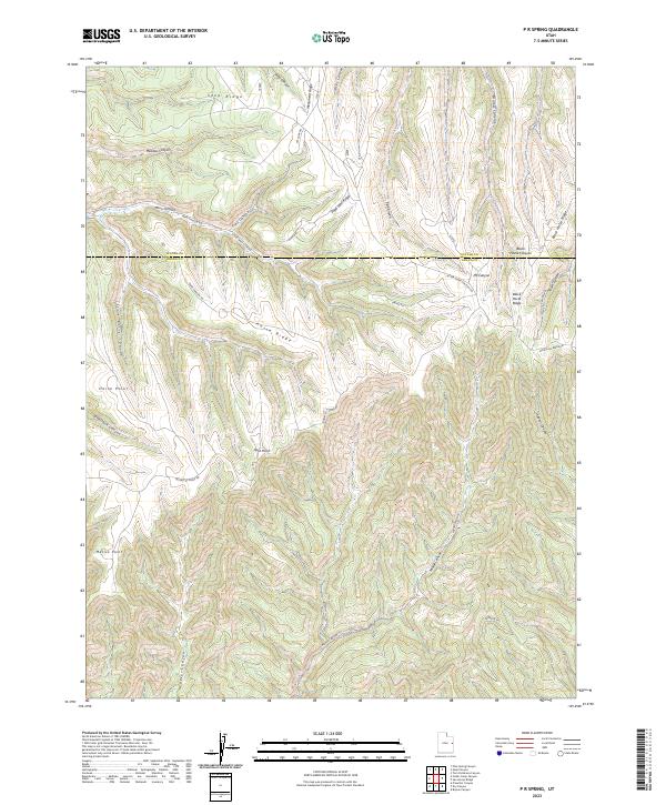
2023 Map of P R Spring
USGS Topo · Published 2023About this map
P R Spring serves as a central water source in this high-elevation corner of the East Tavaputs Plateau, situated right at the boundary of Uintah and Grand counties. The landscape is defined by long, narrow ridges including Seep Ridge, Pope Well Ridge, and Black Horse Ridge, which separate a complex network of canyons such as Meadow Canyon, Main Canyon, and Hideout Canyon. Human activity is primarily represented by industrial and access infrastructure, notably the Pope Well and a series of rugged paths like Main Canyon Rd and Bookcliff Ridge Rd. The geography shows a classic Western drainage pattern where features like Mexico Point and Horse Point overlook deep erosional cuts, while the transition between t15.5s r23e and t15.5s r24e marks the formal surveying of this isolated terrain.
Find a feature on this map
36 named features on this map. Tap any name to fly to it.
Don’t see what you’re looking for? This feature index may not catch every label — zoom into the map to look around manually.
Map Details
Editions of this 2023 P R Spring Map
This is the sole edition of this map. No revisions or reprints were ever made.
Other maps of this area

1885 · East Tavaputs
USGS Topo · 1:250,000

1956 · Grand Junction
USGS Topo · 1:250,000

1959 · Grand Junction
USGS Topo · 1:250,000

1960 · Grand Junction
USGS Topo · 1:250,000

1962 · Grand Junction
USGS Topo · 1:250,000

1964 · Grand Junction
USGS Topo · 1:250,000

1965 · Grand Junction
USGS Topo · 1:250,000

1966 · Seep Canyon
USGS Topo · 1:24,000

1966 · Tom Patterson Canyon
USGS Topo · 1:24,000
1966 · Pine Spring Canyon
USGS Topo · 1:24,000