
2017 Map of Pacific Lake
USGS Topo · Published 2017About this map
Pacific Lake and its surrounding wetlands form the center of this 2017 survey on the boundary of Washington-Lincoln Co. The landscape is defined by a network of basins including Eagle Spring Lake, Wederspahn Lake, and Tavares Lake, many of which are situated along the drainage of Lake Cr. Rising above these water bodies is Coffeepot Butte, a prominent topographical landmark in the northeast quadrant. The map reveals a rural land-use pattern dominated by a section-line road system, featuring family-named routes such as Zagelow Rd N, Deife Rd N, and Schott Rd N. This detailed USGS rendering illustrates the hydrological complexity of the area's numerous small lakes and the persistent infrastructure of agricultural access roads in the eastern Washington interior.
Find a feature on this map
27 named features on this map. Tap any name to fly to it.
Don’t see what you’re looking for? This feature index may not catch every label — zoom into the map to look around manually.
Map Details
Editions of this 2017 Pacific Lake Map
This is the sole edition of this map. No revisions or reprints were ever made.
Other maps of this area

1953 · Ritzville
USGS Topo · 1:250,000

1959 · Ritzville
USGS Topo · 1:250,000

1965 · Ritzville
USGS Topo · 1:250,000

1968 · Irby
USGS Topo · 1:24,000

1968 · Sylvan Lake
USGS Topo · 1:24,000

1968 · Coffeepot Lake
USGS Topo · 1:24,000

1968 · Pacific Lake
USGS Topo · 1:24,000
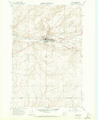
1968 · Odessa
USGS Topo · 1:24,000

1968 · Sullivan Lake
USGS Topo · 1:24,000

1969 · Almira SE
USGS Topo · 1:24,000