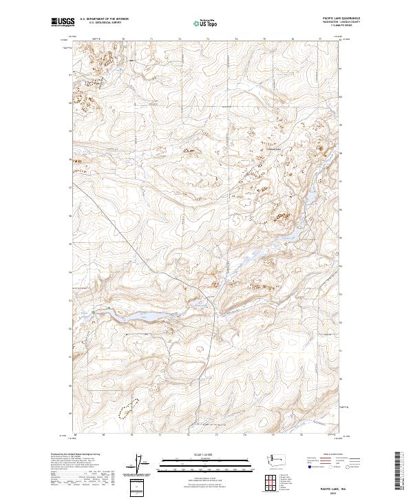
2023 Map of Pacific Lake
USGS Topo · Published 2023About this map
Pacific Lake and its surrounding wetlands form the center of this Lincoln County landscape, where the seasonal flow of Lake Creek connects a series of shallow basins. The area's hydrology is characterized by small, distinct water bodies such as Wederspahn Lake, Walter Lake, and Tavares Lake, often located within subtle depressions like Martin Hollow. This terrain is representative of the Channeled Scablands, where ancient floods left behind a complex network of coulees and buttes.
Find a feature on this map
25 named features on this map. Tap any name to fly to it.
Don’t see what you’re looking for? This feature index may not catch every label — zoom into the map to look around manually.
Map Details
Editions of this 2023 Pacific Lake Map
This is the sole edition of this map. No revisions or reprints were ever made.
Other maps of this area

1953 · Ritzville
USGS Topo · 1:250,000

1959 · Ritzville
USGS Topo · 1:250,000

1965 · Ritzville
USGS Topo · 1:250,000

1968 · Irby
USGS Topo · 1:24,000

1968 · Sylvan Lake
USGS Topo · 1:24,000

1968 · Coffeepot Lake
USGS Topo · 1:24,000

1968 · Pacific Lake
USGS Topo · 1:24,000
1968 · Odessa
USGS Topo · 1:24,000

1968 · Sullivan Lake
USGS Topo · 1:24,000

1969 · Almira SE
USGS Topo · 1:24,000