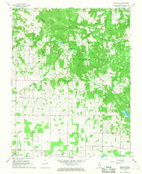
1967 Map of Paducah NE
USGS Topo · Published 1968About this map
The Shawnee National Forest occupies the northern half of this terrain, where the deeply dissected uplands of southern Illinois meet the floodplains of the Ohio River valley. This 1967 survey reveals a landscape densely populated with small family and community landmarks, particularly evident in the high concentration of burial grounds such as Masonic Cem, Golightly Cem, and the uniquely named Buzzard Roost Cem. These sites, along with rural congregations like Mt Pleasant Ch and Azotus Ch, suggest the deep-rooted genealogical history of Massac and Pope counties.
Find a feature on this map
51 named features on this map. Tap any name to fly to it.
Don’t see what you’re looking for? This feature index may not catch every label — zoom into the map to look around manually.
Map Details
Editions of this 1967 Paducah NE Map
2 editions found
Other maps of this area

1916 · Golconda
USGS Topo · 1:62,500

1917 · Brownfield
USGS Topo · 1:62,500

1920 · Goloonda
USGS Topo · 1:48,000

1921 · Golconda
USGS Topo · 1:62,500

1926 · Paducah
USGS Topo · 1:62,500

1929 · Smithland
USGS Topo · 1:62,500

1929 · Paducah
USGS Topo · 1:62,500

1936 · Paducah
USGS Topo · 1:24,000

1936 · Smithland
USGS Topo · 1:48,000

1936 · Little Cypress
USGS Topo · 1:24,000