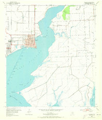
1952 Map of Palacios
USGS Topo · Published 1973About this map
The coastal settlement of Palacios sits prominently on the western shore of Tres Palacios Bay, defined by its grid of streets and key civic structures like the P.O. and High Sch. To the west, the expansive grounds of Camp Hulen mark the landscape, while the Southern Pacific railroad provides a vital inland connection. The geography is dominated by the shifting interface of land and water, featuring Matagorda Bay to the south and smaller bodies like Oyster Lake and Mad Island Lake.
Find a feature on this map
24 named features on this map. Tap any name to fly to it.
Don’t see what you’re looking for? This feature index may not catch every label — zoom into the map to look around manually.
Map Details
Editions of this 1952 Palacios Map
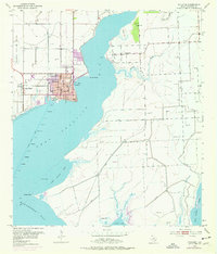
Other maps of this area

1952 · Palacios SE
USGS Topo · 1:24,000

1952 · Palacios Point
USGS Topo · 1:24,000

1952 · Blessing SE
USGS Topo · 1:24,000

1952 · Palacios
USGS Topo · 1:24,000

1952 · Turtle Bay
USGS Topo · 1:24,000

1952 · Francitas
USGS Topo · 1:24,000

1952 · Blessing
USGS Topo · 1:24,000

1952 · Palacios NE
USGS Topo · 1:24,000

1953 · Beeville
USGS Topo · 1:250,000

1956 · Beeville
USGS Topo · 1:250,000