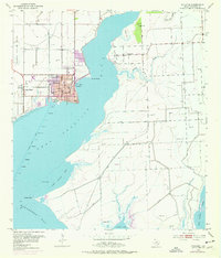
1952 Map of Palacios
USGS Topo · Published 1976About this map
Palacios anchors this coastal survey, showing the town's grid and development alongside the deep indentations of Tres Palacios Bay and Matagorda Bay. To the west of the city center lies Camp Hulen, a site of significant local military history, while the Southern Pacific railroad line provides a land-based link to the interior. The landscape is a network of low-lying wetlands and protective engineering, evidenced by the extensive Levee systems guarding against the tides.
Find a feature on this map
26 named features on this map. Tap any name to fly to it.
Don’t see what you’re looking for? This feature index may not catch every label — zoom into the map to look around manually.
Map Details
Editions of this 1952 Palacios Map
Other maps of this area

1952 · Palacios SE
USGS Topo · 1:24,000

1952 · Palacios Point
USGS Topo · 1:24,000

1952 · Blessing SE
USGS Topo · 1:24,000

1952 · Palacios
USGS Topo · 1:24,000

1952 · Turtle Bay
USGS Topo · 1:24,000

1952 · Francitas
USGS Topo · 1:24,000

1952 · Blessing
USGS Topo · 1:24,000

1952 · Palacios NE
USGS Topo · 1:24,000

1953 · Beeville
USGS Topo · 1:250,000

1956 · Beeville
USGS Topo · 1:250,000