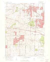
1961 Map of Palatine
USGS Topo · Published 1962About this map
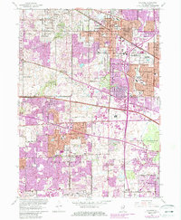
The Arlington Park Race Track and its expansive Parking Area dominate the landscape of northwestern Cook County during this era of rapid suburban expansion. The transition from rural farmland to residential communities is evident in the sprawling village boundaries of Palatine, Rolling Meadows, and Hoffman Estates. Infrastructure for a growing population is marked by numerous new educational and religious sites, such as Hillside Sch, St Hubert Sch, and Township High Sch.
Find a feature on this map
59 named features on this map. Tap any name to fly to it.
Don’t see what you’re looking for? This feature index may not catch every label — zoom into the map to look around manually.
Map Details
Editions of this 1961 Palatine Map
5 editions found
Other maps of this area

1891 · Riverside
USGS Topo · 1:62,500

1893 · Riverside
USGS Topo · 1:62,500

1900 · Riverside
USGS Topo · 1:62,500

1900 · Highwood
USGS Topo · 1:62,500

1901 · Riverside
USGS Topo · 1:62,500

1908 · Wheaton
USGS Topo · 1:62,500

1923 · Barrington
USGS Topo · 1:62,500

1927 · Arlington Heights
USGS Topo · 1:24,000

1928 · Elmhurst
USGS Topo · 1:24,000

1928 · Wheeling
USGS Topo · 1:24,000