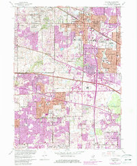
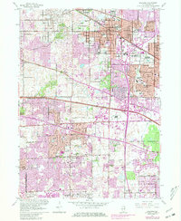
1961 Map of Palatine
USGS Topo · Published 1987About this map
Palatine and its neighboring villages underwent significant expansion in the mid-20th century, a transition documented through detailed updates to this 1961 survey. The landscape is a mix of established residential pockets and evolving infrastructure, such as the Arlington Park Racetrack and various educational and religious institutions including St Theresa Sch and St John Ch. The Chicago and North Western railroad cuts across the northern section, anchoring the transit corridor through Arlington Heights. To the south, the Ned Brown Preserve and the winding Salt Creek offer a natural contrast to the rapid growth seen in Hoffman Estates and Schaumburg. The map also captures specialized land use of the era, from the U S Military Reservation to the prominent Radio Towers (WGN) near Elk Grove.
Find a feature on this map
53 named features on this map. Tap any name to fly to it.
Don’t see what you’re looking for? This feature index may not catch every label — zoom into the map to look around manually.
Map Details
Editions of this 1961 Palatine Map
5 editions found
Other maps of this area

1891 · Riverside
USGS Topo · 1:62,500

1893 · Riverside
USGS Topo · 1:62,500

1900 · Riverside
USGS Topo · 1:62,500

1900 · Highwood
USGS Topo · 1:62,500

1901 · Riverside
USGS Topo · 1:62,500

1908 · Wheaton
USGS Topo · 1:62,500

1923 · Barrington
USGS Topo · 1:62,500

1927 · Arlington Heights
USGS Topo · 1:24,000

1928 · Elmhurst
USGS Topo · 1:24,000

1928 · Wheeling
USGS Topo · 1:24,000