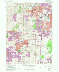
1961 Map of Palatine
USGS Topo · Published 1973About this map
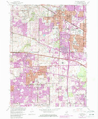
Palatine and its neighboring townships in Cook County show the rapid suburban expansion characteristic of the early 1970s. This survey identifies a network of new residential streets and commercial centers superimposed over an older agricultural and rail-oriented landscape. The Chicago and North Western corridor anchors the northern development, passing through the established heart of Palatine. To the southeast, the massive Arlington Park Race Track and its expansive Parking Area dominate the border with Rolling Meadows, while William Rainey Harper College represents the era's growing institutional footprint. Substantial green spaces like the Ned Brown Preserve contrast with the purple-tinted urban extensions in Hoffman Estates and Schaumburg. Local history is preserved in sites like St Michael Cemetery and the U S Military Reservation (Arlington Heights), marking the diverse uses of the land before it was fully enveloped by the Chicago metropolitan sprawl.
Find a feature on this map
80 named features on this map. Tap any name to fly to it.
Don’t see what you’re looking for? This feature index may not catch every label — zoom into the map to look around manually.
Map Details
Editions of this 1961 Palatine Map
5 editions found
Other maps of this area

1891 · Riverside
USGS Topo · 1:62,500

1893 · Riverside
USGS Topo · 1:62,500

1900 · Riverside
USGS Topo · 1:62,500

1900 · Highwood
USGS Topo · 1:62,500

1901 · Riverside
USGS Topo · 1:62,500

1908 · Wheaton
USGS Topo · 1:62,500

1923 · Barrington
USGS Topo · 1:62,500

1927 · Arlington Heights
USGS Topo · 1:24,000

1928 · Elmhurst
USGS Topo · 1:24,000

1928 · Wheeling
USGS Topo · 1:24,000