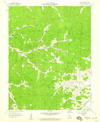
1958 Map of Palmer
USGS Topo · Published 1959About this map
Mining operations and small rural communities define this portion of the Clark National Forest during the late 1950s. The landscape is marked by numerous extraction sites, including those near Palmer and along Stringtown Branch, characterized by several Mines and associated Tailings Ponds. These industrial features sit alongside established social centers such as Marler Chapel and Lizzie Ch.
Find a feature on this map
38 named features on this map. Tap any name to fly to it.
Don’t see what you’re looking for? This feature index may not catch every label — zoom into the map to look around manually.
Map Details
Editions of this 1958 Palmer Map
4 editions found
Other maps of this area

1906 · Potosi
USGS Topo · 1:62,500

1924 · Edgehill
USGS Topo · 1:62,500

1926 · Edgehill
USGS Topo · 1:62,500

1943 · Berryman
USGS Topo · 1:62,500

1943 · Boss
USGS Topo · 1:62,500

1945 · Berryman
USGS Topo · 1:62,500

1946 · Boss
USGS Topo · 1:62,500

1949 · Rolla
USGS Topo · 1:250,000

1953 · Rolla
USGS Topo · 1:250,000

1954 · Rolla
USGS Topo · 1:250,000