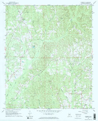
1967 Map of Palmetto
USGS Topo · Published 1968About this map
Palmetto and its surrounding rural communities in northern Pickens County are defined by a network of small churches and cemeteries that anchored local life in the late 1960s. The landscape is deeply dissected by numerous watercourses, including Lubbub Creek, Beaver Creek, and Linebarger Creek, which dictate the winding paths of the local road system. Genealogists will find significant value in the documentation of family and community landmarks like Mt Tabor Cem, Unity Grove Ch, and Big Hill Ch Cem.
Find a feature on this map
34 named features on this map. Tap any name to fly to it.
Don’t see what you’re looking for? This feature index may not catch every label — zoom into the map to look around manually.
Map Details
Editions of this 1967 Palmetto Map
2 editions found
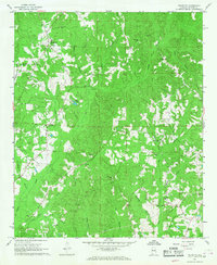
Other maps of this area

1953 · Birmingham
USGS Topo · 1:250,000

1953 · West Point
USGS Topo · 1:250,000

1956 · Birmingham
USGS Topo · 1:250,000

1957 · Birmingham
USGS Topo · 1:250,000

1958 · West Point
USGS Topo · 1:250,000

1963 · West Point
USGS Topo · 1:250,000

1967 · Carrollton
USGS Topo · 1:24,000

1967 · Brownville
USGS Topo · 1:24,000

1967 · Newtonville
USGS Topo · 1:24,000

1967 · Kennedy
USGS Topo · 1:24,000