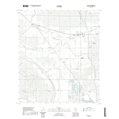
2020 Map of Palmetto
USGS Topo · Published 2020About this map
St. Landry Parish's alluvial landscape is defined by the winding paths of Bayou Petite Prairie and Dick Bayou, which influence the placement of rural settlements and transport corridors. The village of Palmetto serves as a local hub near the Union Pacific Railroad, where several historic burial grounds are clustered, including Saint Thomas the Apostle Catholic Cem and the Palmetto Methodist Cem. Further west, the community of Lebeau sits at the intersection of LA 361 and LA 10, marked by the Immaculate Conception Catholic Cem. This survey illustrates a resilient agricultural and bayou-based geography, where place names like Waxia, Bolden, and Rideau Settlement denote small nodes of activity. The eastern edge of the map is bordered by the West Atchafalaya Floodway, a massive engineering feature designed to manage the seasonal waters of the Mississippi basin, contrasting with the many smaller waterways like Negro Foot Bayou and Hog Bayou that drain the local prairies.
Find a feature on this map
79 named features on this map. Tap any name to fly to it.
Don’t see what you’re looking for? This feature index may not catch every label — zoom into the map to look around manually.
Map Details
Editions of this 2020 Palmetto Map
This is the sole edition of this map. No revisions or reprints were ever made.
Other maps of this area

1939 · Opelousas
USGS Topo · 1:62,500

1948 · Bunkie
USGS Topo · 1:62,500

1952 · Lake Charles
USGS Topo · 1:250,000

1954 · Lake Charles
USGS Topo · 1:250,000

1954 · Baton Rouge
USGS Topo · 1:250,000

1955 · Odenburg
USGS Topo · 1:62,500

1956 · Opelousas
USGS Topo · 1:62,500

1956 · Baton Rouge
USGS Topo · 1:250,000

1957 · Opelousas
USGS Topo · 1:62,500

1959 · Palmetto
USGS Topo · 1:62,500