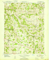
1950 Map of Palmyra
USGS Topo · Published 1950About this map
Palmyra stands at the intersection of local travel routes in this 1950 survey, serving as a hub near the convergence of Harrison, Washington, and Floyd Counties. The landscape is defined by the winding paths of the Blue River and the South Fork Blue River, which carve through the townships of Pierce, Jackson, and Morgan. This era captures a rural Indiana community deeply rooted in its local institutions, evidenced by the numerous country churches like Big Springs Ch and Bethlehem Ch that dot the countryside.
Find a feature on this map
31 named features on this map. Tap any name to fly to it.
Don’t see what you’re looking for? This feature index may not catch every label — zoom into the map to look around manually.
Map Details
Editions of this 1950 Palmyra Map
2 editions found
Other maps of this area

1939 · Georgetown
USGS Topo · 1:24,000

1941 · Borden
USGS Topo · 1:24,000

1946 · Depauw
USGS Topo · 1:24,000

1947 · Georgetown
USGS Topo · 1:24,000

1949 · Georgetown
USGS Topo · 1:24,000

1950 · Salem
USGS Topo · 1:24,000

1950 · Becks Mill
USGS Topo · 1:24,000

1950 · Palmyra
USGS Topo · 1:24,000
1952 · Georgetown
USGS Topo · 1:24,000

1953 · Fredericksburg
USGS Topo · 1:24,000