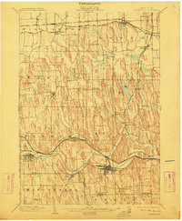
1902 Map of Palmyra
USGS Topo · Published 1911About this map
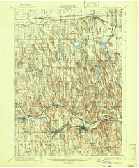
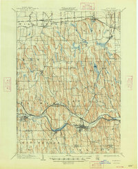
Erie Canal traffic and a dense network of steam and electric railways define this turn-of-the-century landscape in Wayne County. The survey captures the region during a peak period of agricultural transit, where the New York Central and Hudson River R. R. and the Rochester and Sodus Bay Electric R. R. parallel the historic canal corridor through Palmyra and Newark. The terrain is characterized by an extraordinary concentration of north-south drumlins, creating a corrugated topography that influenced the placement of early settlements like Marion and Sodus.
Find a feature on this map
47 named features on this map. Tap any name to fly to it.
Don’t see what you’re looking for? This feature index may not catch every label — zoom into the map to look around manually.
Map Details
Editions of this 1902 Palmyra Map
7 editions found
Other maps of this area

1899 · Palmyra
USGS Topo · 1:62,500

1900 · Macedon
USGS Topo · 1:62,500

1900 · Canandaigua
USGS Topo · 1:62,500

1902 · Sodus Bay
USGS Topo · 1:62,500

1902 · Pultneyville
USGS Topo · 1:62,500

1902 · Geneva
USGS Topo · 1:62,500

1902 · Clyde
USGS Topo · 1:62,500

1902 · Phelps
USGS Topo · 1:62,500

1902 · Palmyra
USGS Topo · 1:62,500

1903 · Canandaigua
USGS Topo · 1:62,500