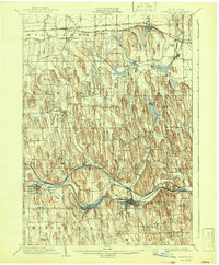
1902 Map of Palmyra
USGS Topo · Published 1942About this map
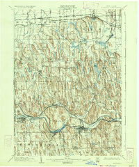
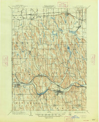
Glacial drumlins dominate the landscape of Wayne County at the turn of the century, creating a distinct north-south corrugated pattern of hills between Ridge Road and the Barge Canal. This survey reveals a dense network of transportation infrastructure essential to the region's agricultural economy, including the New York Central and Hudson River R. R. and the Rochester and Sodus Bay Electric R. R. feeding into lakeside hubs like Sodus. In the southern portion of the quadrangle, the village of Palmyra and the neighboring Newark serve as primary centers along the canal and the West Shore R. R.. Significant local landmarks like Mormon Hill and Pigeon Hill rise above the surrounding creek valleys, while smaller settlements such as Sodus Center, Marion, and East Palmyra are mapped in detail before the mid-century expansion of local road systems.
Find a feature on this map
44 named features on this map. Tap any name to fly to it.
Don’t see what you’re looking for? This feature index may not catch every label — zoom into the map to look around manually.
Map Details
Editions of this 1902 Palmyra Map
7 editions found
Other maps of this area

1899 · Palmyra
USGS Topo · 1:62,500

1900 · Macedon
USGS Topo · 1:62,500

1900 · Canandaigua
USGS Topo · 1:62,500

1902 · Sodus Bay
USGS Topo · 1:62,500

1902 · Pultneyville
USGS Topo · 1:62,500

1902 · Geneva
USGS Topo · 1:62,500

1902 · Clyde
USGS Topo · 1:62,500

1902 · Phelps
USGS Topo · 1:62,500

1902 · Palmyra
USGS Topo · 1:62,500

1903 · Canandaigua
USGS Topo · 1:62,500