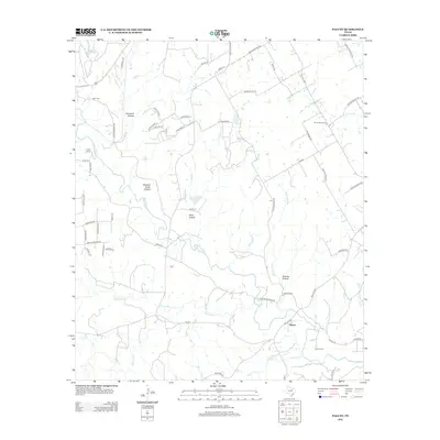
2012 Map of Paluxy
USGS Topo · Published 2012About this map
The Paluxy River carves a winding path through this portion of Hood County, anchoring a landscape defined by deep draws and named tributaries. Small rural communities and gathering places like the settlement of Paluxy and the Panter Branch Hall reflect the area's agricultural and social history. The terrain is marked by distinctive topographical features such as Buzzard Roost Hollow, Windmill Hollow, and Goss Hollow, which indicate the natural drainage patterns feeding into the river system. Local transit is facilitated by a network of ranch and county roads, including the historic Bakers Crossing Rd and Rock Church Hwy. Genealogists and local historians will find value in the presence of the Glenn Cem and Brooks Cem, while recreational interest is represented by Camp Paluxy and the northern reach of Texas A and M Lake.
Find a feature on this map
64 named features on this map. Tap any name to fly to it.
Don’t see what you’re looking for? This feature index may not catch every label — zoom into the map to look around manually.
Map Details
Editions of this 2012 Paluxy Map
This is the sole edition of this map. No revisions or reprints were ever made.
Other maps of this area

1889 · Granbury
USGS Topo · 1:125,000

1890 · Stephenville
USGS Topo · 1:125,000

1920 · Stephenville
USGS Topo · 1:125,000

1923 · Granbury 2-a
USGS Topo · 1:48,000

1931 · Tolar
USGS Topo · 1:62,500

1954 · Dallas
USGS Topo · 1:250,000

1954 · Abilene
USGS Topo · 1:250,000

1958 · Dallas
USGS Topo · 1:250,000

1958 · Abilene
USGS Topo · 1:250,000
1960 · Tolar
USGS Topo · 1:24,000