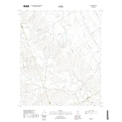
2019 Map of Paluxy
USGS Topo · Published 2019About this map
Paluxy sits at the intersection of rural Texas life and a landscape defined by the winding course of the Paluxy River. This 2019 survey captures the area as modern residential development begins to mark the hills, with new roads like Majestic Shores and Overlook Ridge appearing near the Texas A and M Lake. Despite these changes, the map remains anchored by traditional landmarks and family history, featuring the Glenn Cem and Brooks Cem, along with numerous geographic hollows such as Windmill Hollow and Goss Hollow.
Find a feature on this map
63 named features on this map. Tap any name to fly to it.
Don’t see what you’re looking for? This feature index may not catch every label — zoom into the map to look around manually.
Map Details
Editions of this 2019 Paluxy Map
This is the sole edition of this map. No revisions or reprints were ever made.
Other maps of this area

1889 · Granbury
USGS Topo · 1:125,000

1890 · Stephenville
USGS Topo · 1:125,000

1920 · Stephenville
USGS Topo · 1:125,000

1923 · Granbury 2-a
USGS Topo · 1:48,000

1931 · Tolar
USGS Topo · 1:62,500

1954 · Dallas
USGS Topo · 1:250,000

1954 · Abilene
USGS Topo · 1:250,000

1958 · Dallas
USGS Topo · 1:250,000

1958 · Abilene
USGS Topo · 1:250,000
1960 · Tolar
USGS Topo · 1:24,000