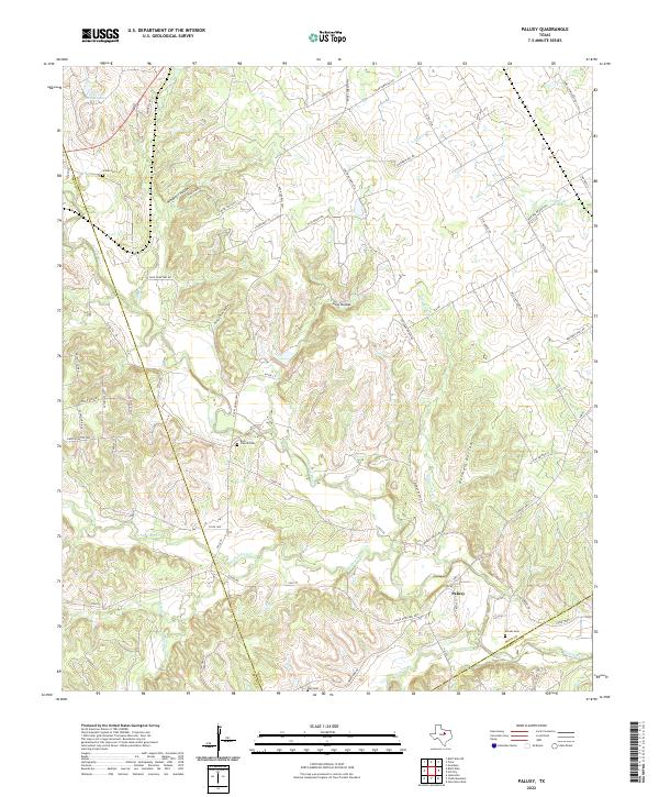
2022 Map of Paluxy
USGS Topo · Published 2022About this map
The Paluxy River winds through the limestone-scored terrain of Hood and Somervell counties, anchoring a rural landscape defined by deep valleys and upland plateaus. The small settlement of Paluxy sits near the confluence of Richardson Cr and Pony Cr, where the riverbed cuts through the surrounding ranchlands. This modern topographic view preserves the locations of several community landmarks essential for local history, including Rock Church Cem and Glenn Cem. The geography is characterized by numerous seasonal drainage channels and named recesses such as Windmill Hollow, Goss Hollow, and Buzzard Roost Hollow. In the northwest corner, Texas A and M Lake provides a notable water feature near the Erath county line. The road network, including the Rock Church Hwy and Coleman Ranch Rd, follows the natural contours of the river valley and the ridges above it.
Find a feature on this map
75 named features on this map. Tap any name to fly to it.
Don’t see what you’re looking for? This feature index may not catch every label — zoom into the map to look around manually.
Map Details
Editions of this 2022 Paluxy Map
This is the sole edition of this map. No revisions or reprints were ever made.
Other maps of this area

1889 · Granbury
USGS Topo · 1:125,000

1890 · Stephenville
USGS Topo · 1:125,000

1920 · Stephenville
USGS Topo · 1:125,000

1923 · Granbury 2-a
USGS Topo · 1:48,000

1931 · Tolar
USGS Topo · 1:62,500

1954 · Dallas
USGS Topo · 1:250,000

1954 · Abilene
USGS Topo · 1:250,000

1958 · Dallas
USGS Topo · 1:250,000

1958 · Abilene
USGS Topo · 1:250,000
1960 · Tolar
USGS Topo · 1:24,000