
1965 Map of Paoli
USGS Topo · Published 1966About this map
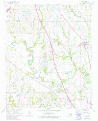
The Washita River carves a winding path through the center of this Garvin County landscape, defining the topography between Paoli and the settlement of Whitebead. During the mid-1960s, the region was characterized by a heavy industrial presence, notably the West Pauls Valley Oil Field and the Pauls Valley Oil Field, which are marked by numerous wells and service roads. The Atchison Topeka and Santa Fe railroad serves as a primary transit corridor, running southeast alongside the river valley and passing near Gagine Sta. Genealogists will find significant local history at the Florence Cem and Whitebead Cem, while the presence of Gravel Pits and a Radio Tower further illustrate the mid-century development of this rural Oklahoma territory.
Find a feature on this map
18 named features on this map. Tap any name to fly to it.
Don’t see what you’re looking for? This feature index may not catch every label — zoom into the map to look around manually.
Map Details
Editions of this 1965 Paoli Map
2 editions found
Other maps of this area

1898 · Pauls Valley
USGS Topo · 1:125,000

1902 · Pauls Valley
USGS Topo · 1:125,000

1957 · Ardmore
USGS Topo · 1:250,000

1963 · Ardmore
USGS Topo · 1:250,000
1965 · Rosedale
USGS Topo · 1:24,000

1965 · Byars SW
USGS Topo · 1:24,000
1965 · Wayne
USGS Topo · 1:24,000

1965 · Pauls Valley
USGS Topo · 1:24,000

1965 · Maysville
USGS Topo · 1:24,000
1965 · Stealy
USGS Topo · 1:24,000