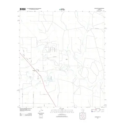
2013 Map of Papalote
USGS Topo · Published 2013About this map
Papalote sits as the central hub of this coastal plain landscape, where the Aransas River winds through a network of intricate creek systems. The map details a transition from traditional ranching to industrial utility, evidenced by the presence of the Papalote Oil Field east of the main settlement. A complex web of rural roads, such as Silver Creek Rd and Baker Rd, connects isolated ranch properties like those accessed via Live Oak Ranch Rd and Windmill Ranch Rd. The drainage pattern is particularly dense, with Papalote Cr, Silver Cr, and Blackjack Cr carving through the terrain before joining the larger river system. This survey reflects the modern infrastructure of Bee County while preserving the footprints of older property divisions and local waterways.
Find a feature on this map
38 named features on this map. Tap any name to fly to it.
Don’t see what you’re looking for? This feature index may not catch every label — zoom into the map to look around manually.
Map Details
Editions of this 2013 Papalote Map
This is the sole edition of this map. No revisions or reprints were ever made.
Other maps of this area

1953 · Beeville
USGS Topo · 1:250,000

1954 · Skidmore
USGS Topo · 1:62,500

1954 · Woodsboro
USGS Topo · 1:62,500

1954 · Sinton
USGS Topo · 1:62,500

1954 · Refugio
USGS Topo · 1:62,500

1956 · Beeville
USGS Topo · 1:250,000

1960 · Beeville
USGS Topo · 1:250,000

1978 · Cranell
USGS Topo · 1:24,000

1978 · Refugio SW
USGS Topo · 1:24,000

1979 · Burkes Ridge
USGS Topo · 1:24,000