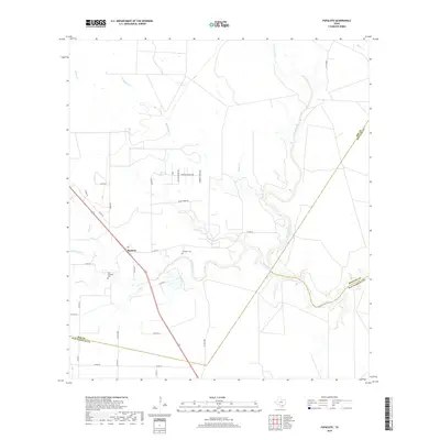
2019 Map of Papalote
USGS Topo · Published 2019About this map
The settlement of Papalote sits at a geographic crossroads in South Texas, where the meandering Aransas River meets a network of seasonal waterways. This landscape is defined by the winding paths of Papalote Cr, Silver Cr, and Blackjack Cr, which carve through the coastal plains. The proximity of Old Papalote Cem and Papalote Cem highlights the long-standing community presence in this corner of Bee County. The map details a transition between rural ranching lands and the natural drainage systems that feed into the Gulf region, showing a sophisticated grid of county roads such as Baker RD and Silver Creek RD that provide access to the various ranch properties and water crossings. This survey captures the rural character of the area where the boundaries of Bee, Refugio, and San Patricio counties converge along the river's edge.
Find a feature on this map
37 named features on this map. Tap any name to fly to it.
Don’t see what you’re looking for? This feature index may not catch every label — zoom into the map to look around manually.
Map Details
Editions of this 2019 Papalote Map
This is the sole edition of this map. No revisions or reprints were ever made.
Other maps of this area

1953 · Beeville
USGS Topo · 1:250,000

1954 · Skidmore
USGS Topo · 1:62,500

1954 · Woodsboro
USGS Topo · 1:62,500

1954 · Sinton
USGS Topo · 1:62,500

1954 · Refugio
USGS Topo · 1:62,500

1956 · Beeville
USGS Topo · 1:250,000

1960 · Beeville
USGS Topo · 1:250,000

1978 · Cranell
USGS Topo · 1:24,000

1978 · Refugio SW
USGS Topo · 1:24,000

1979 · Burkes Ridge
USGS Topo · 1:24,000