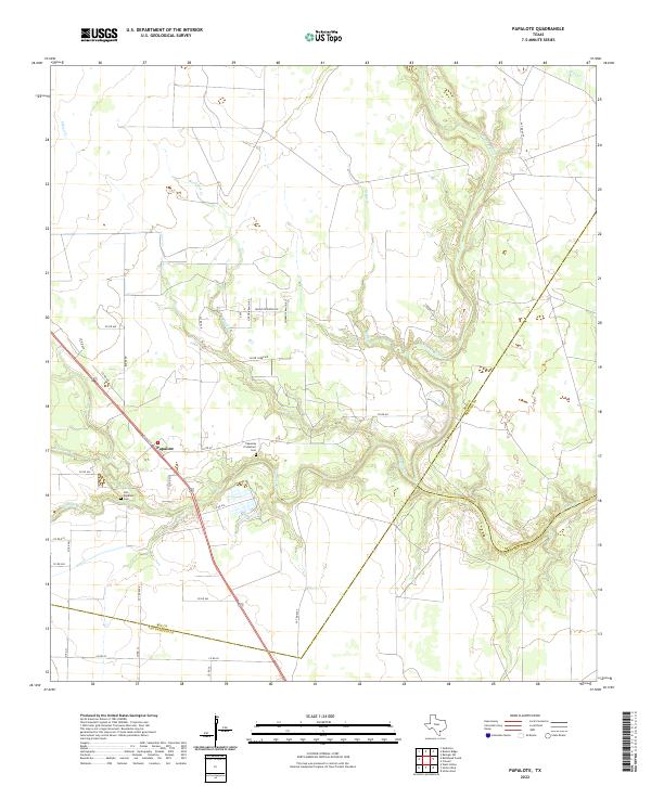
2022 Map of Papalote
USGS Topo · Published 2022About this map
The settlement of Papalote sits at the intersection of rural South Texas ranch roads and the winding Papalote Cr, where the riparian landscape meets the open coastal plains. This area on the Bee County border is defined by a dense network of watercourses, including the Aransas River and Silver Cr, which drain the low-lying prairie. The map provides significant detail for genealogists and local historians, clearly marking the Old Papalote Cem and the Papalote Protestant Cem, reflecting the early community centers of this historic ranching region. The modern road network, including numerous private and county routes like Silver Creek Rd and Papalote Ranch Rd, overlays a landscape still deeply influenced by its original natural drainage patterns, from Blackjack Cr to the southern reaches of Boggy Cr.
Find a feature on this map
39 named features on this map. Tap any name to fly to it.
Don’t see what you’re looking for? This feature index may not catch every label — zoom into the map to look around manually.
Map Details
Editions of this 2022 Papalote Map
This is the sole edition of this map. No revisions or reprints were ever made.
Other maps of this area

1953 · Beeville
USGS Topo · 1:250,000

1954 · Skidmore
USGS Topo · 1:62,500

1954 · Woodsboro
USGS Topo · 1:62,500

1954 · Sinton
USGS Topo · 1:62,500

1954 · Refugio
USGS Topo · 1:62,500

1956 · Beeville
USGS Topo · 1:250,000

1960 · Beeville
USGS Topo · 1:250,000

1978 · Cranell
USGS Topo · 1:24,000

1978 · Refugio SW
USGS Topo · 1:24,000

1979 · Burkes Ridge
USGS Topo · 1:24,000