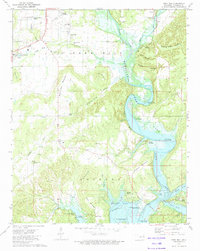
1973 Map of Park Hill
USGS Topo · Published 1974About this map
Park Hill serves as a focal point for Cherokee history and culture in this early 1970s survey, featuring the Tsa La Gi Indian Village and Murrell Home Park. The landscape is defined by the winding course of the Illinois River, which feeds into the northern reaches of Tenkiller Ferry Lake. Settlement patterns here show a mix of established residential areas like Green Country Estates and Indian Meadows alongside older, family-named landmarks.
Find a feature on this map
66 named features on this map. Tap any name to fly to it.
Don’t see what you’re looking for? This feature index may not catch every label — zoom into the map to look around manually.
Map Details
Editions of this 1973 Park Hill Map
2 editions found
Other maps of this area

1898 · Tahlequah
USGS Topo · 1:125,000

1901 · Muscogee
USGS Topo · 1:125,000

1901 · Tahlequah
USGS Topo · 1:125,000

1905 · Muscogee
USGS Topo · 1:125,000

1905 · Tahlequah
USGS Topo · 1:125,000

1946 · Fort Smith
USGS Topo · 1:250,000

1948 · Hulbert
USGS Topo · 1:62,500

1948 · Webbers Falls
USGS Topo · 1:62,500

1950 · Hulbert
USGS Topo · 1:62,500

1950 · Webbers Falls
USGS Topo · 1:62,500