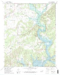
1973 Map of Park Hill
USGS Topo · Published 1974About this map
The hills and valleys of Cherokee County are documented here during the early 1970s, showcasing a landscape defined by the winding Illinois River and the expanding reach of Tenkiller Ferry Lake. The map highlights important cultural landmarks such as the Tsa La Gi Indian Village and the historic Cherokee Home Mission. For genealogists, several burial grounds are clearly marked, including Park Hill Cem, Worster Cem, and Ross Cem, often situated near family-named landmarks like Park Hill Mountain and Murrell Home Park Branch. The transition from rural homesteads to recreational areas is evident in the numerous public access points along the water, such as Carters Landing and Strayhorn Landing Public Use Area. The map also captures educational and spiritual hubs like the Sequoyah Sch and Keys Mission Ch, which served the communities of Park Hill and Keys.
Find a feature on this map
59 named features on this map. Tap any name to fly to it.
Don’t see what you’re looking for? This feature index may not catch every label — zoom into the map to look around manually.
Map Details
Editions of this 1973 Park Hill Map
2 editions found
Other maps of this area

1898 · Tahlequah
USGS Topo · 1:125,000

1901 · Muscogee
USGS Topo · 1:125,000

1901 · Tahlequah
USGS Topo · 1:125,000

1905 · Muscogee
USGS Topo · 1:125,000

1905 · Tahlequah
USGS Topo · 1:125,000

1946 · Fort Smith
USGS Topo · 1:250,000

1948 · Hulbert
USGS Topo · 1:62,500

1948 · Webbers Falls
USGS Topo · 1:62,500

1950 · Hulbert
USGS Topo · 1:62,500

1950 · Webbers Falls
USGS Topo · 1:62,500