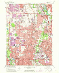
1963 Map of Park Ridge
USGS Topo · Published 1973About this map
Glenview Naval Air Station anchors the center of this suburban Cook County landscape, illustrating the significant military and aviation footprint in the region during the post-war era. The map details the rapid expansion of residential areas and school systems, including Glenbrook North High Sch and Maine East High Sch, as they grew to accommodate the mid-century population boom. A striking belt of green space follows the North Branch Chicago River and the Skokie Lagoons Forest Preserve, providing a permanent natural corridor through the dense development of Glenview, Park Ridge, and Skokie. Notable religious and institutional landmarks, such as St Mary of the Lake Seminary and St Marys Mission House, stand alongside numerous historic burial grounds like Maryhill Cemetery and St Adalberts Cemetery, serving as vital anchors for local genealogical research.
Find a feature on this map
94 named features on this map. Tap any name to fly to it.
Don’t see what you’re looking for? This feature index may not catch every label — zoom into the map to look around manually.
Map Details
Editions of this 1963 Park Ridge Map
Other maps of this area

1889 · Chicago
USGS Topo · 1:62,500

1891 · Chicago
USGS Topo · 1:62,500

1891 · Riverside
USGS Topo · 1:62,500

1893 · Riverside
USGS Topo · 1:62,500

1899 · Evanston
USGS Topo · 1:62,500

1900 · Chicago
USGS Topo · 1:62,500

1900 · Riverside
USGS Topo · 1:62,500

1900 · Highwood
USGS Topo · 1:62,500

1901 · Riverside
USGS Topo · 1:62,500

1901 · Chicago
USGS Topo · 1:62,500