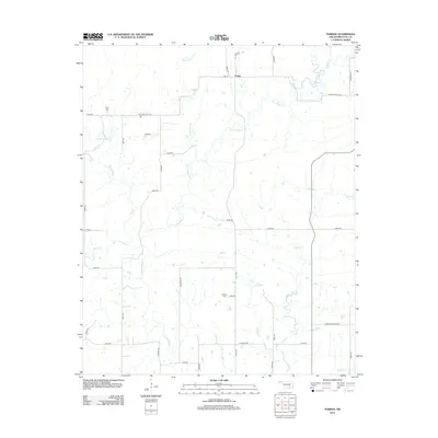
2012 Map of Parker
USGS Topo · Published 2012About this map
Parker serves as the primary landmark in this rural section of Coal County, situated near the confluence of several winding waterways. The landscape is defined by the complex drainage patterns of Muddy Boggy Cr and Caney Boggy Cr, which dominate the central and western portions of the quadrangle. These creeks, along with smaller tributaries like Sweetwater Cr and Rock Cr, create a highly dissected topography that has historically influenced the placement of local roads and farmsteads.
Find a feature on this map
39 named features on this map. Tap any name to fly to it.
Don’t see what you’re looking for? This feature index may not catch every label — zoom into the map to look around manually.
Map Details
Editions of this 2012 Parker Map
This is the sole edition of this map. No revisions or reprints were ever made.
Other maps of this area

1896 · Coalgate
USGS Topo · 1:125,000

1899 · Coalgate
USGS Topo · 1:125,000

1900 · Coalgate
USGS Topo · 1:125,000

1957 · Coalgate
USGS Topo · 1:24,000

1957 · Coalgate SE
USGS Topo · 1:24,000

1957 · Centrahoma
USGS Topo · 1:24,000

1957 · Tupelo NE
USGS Topo · 1:24,000

1957 · Ardmore
USGS Topo · 1:250,000

1963 · Ardmore
USGS Topo · 1:250,000
1967 · Wardville
USGS Topo · 1:24,000