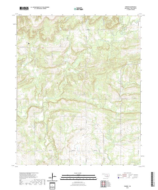
2022 Map of Parker
USGS Topo · Published 2022About this map
The unincorporated community of Parker serves as the focal point for this landscape in Coal County, defined by a complex network of tributaries feeding into larger drainage systems. The northern reaches are shaped by the flow of Sweetwater Cr and Ranch Cr, while the southern and central sections are drained by Muddy Boggy Cr, Caney Boggy Cr, and Salt Creek. This modern survey illustrates the persistent rural infrastructure of the region, where gravel and section-line roads like Ross Reed Rd and S Farris Rd connect isolated homesteads and historical sites. Genealogists will find the locations of Pine Cem in the northwest and McCarty Cem further south particularly valuable for tracing family roots in the area. The map reveals how the terrain's hydrology has influenced local naming conventions and settlement patterns throughout the Township 2 and 3 North districts.
Find a feature on this map
35 named features on this map. Tap any name to fly to it.
Don’t see what you’re looking for? This feature index may not catch every label — zoom into the map to look around manually.
Map Details
Editions of this 2022 Parker Map
This is the sole edition of this map. No revisions or reprints were ever made.
Other maps of this area

1896 · Coalgate
USGS Topo · 1:125,000

1899 · Coalgate
USGS Topo · 1:125,000

1900 · Coalgate
USGS Topo · 1:125,000

1957 · Coalgate
USGS Topo · 1:24,000

1957 · Coalgate SE
USGS Topo · 1:24,000

1957 · Centrahoma
USGS Topo · 1:24,000

1957 · Tupelo NE
USGS Topo · 1:24,000

1957 · Ardmore
USGS Topo · 1:250,000

1963 · Ardmore
USGS Topo · 1:250,000
1967 · Wardville
USGS Topo · 1:24,000